Monroe Township, Carroll County, Indiana
Monroe Township | |
|---|---|
 Fields west of Flora
| |
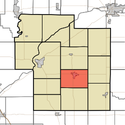 Location of Monroe Township in Carroll County
| |
| Coordinates: 40°32′01″N 86°31′30″W | |
| Country | United States |
| State | Indiana |
| County | Carroll |
| Government | |
| • Type | Indiana township |
| Area | |
| • Total | 24.06 sq mi (62.3 km2) |
| • Land | 24.04 sq mi (62.3 km2) |
| • Water | 0.02 sq mi (0.05 km2) |
| Elevation | 709 ft (216 m) |
| Population
(2010)
| |
| • Total | 2,797 |
| • Density | 116.3/sq mi (44.9/km2) |
| FIPS code | 18-50256 |
| GNIS feature ID | 453635 |
Monroe Township is one of fourteen townships in Carroll County, Indiana. As of the 2010 census, its population was 2,797 and it contained 1,265 housing units.
History
Monroe Township was organized in 1840.
Geography
According to the 2010 census, the township has a total area of 24.06 square miles (62.3 km2), of which 24.04 square miles (62.3 km2) (or 99.92%) is land and 0.02 square miles (0.052 km2) (or 0.08%) is water.
Cities and towns
Unincorporated towns
Adjacent townships
- Jackson (north)
- Carrollton (east)
- Burlington (southeast)
- Democrat (south)
- Madison (west)
- Deer Creek (northwest)
Major highways
Cemeteries
The township contains three cemeteries: Maple Lawn, Moss, and Shirar Landis.
Education
Monroe Township residents may obtain a library card at the Flora-Monroe Township Public Library in Flora.