West Arnhem Region
|
West Arnhem Region Northern Territory | |||||||||||||||
|---|---|---|---|---|---|---|---|---|---|---|---|---|---|---|---|
 | |||||||||||||||
| Population | 6,902 (2018) | ||||||||||||||
| • Density | 0.138943/km2 (0.359861/sq mi) | ||||||||||||||
| Established | 2008 | ||||||||||||||
| Area | 49,675 km2 (19,179.6 sq mi) | ||||||||||||||
| Mayor | Matthew Ryan | ||||||||||||||
| Council seat | Jabiru | ||||||||||||||
| Region | Arnhem Land | ||||||||||||||
| Territory electorate(s) | Arafura | ||||||||||||||
| Federal division(s) | Lingiari | ||||||||||||||
 | |||||||||||||||
| Website | West Arnhem Region | ||||||||||||||
| |||||||||||||||
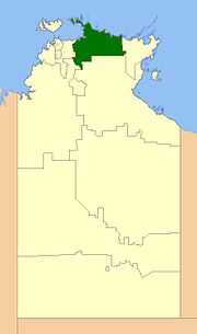
The West Arnhem Region is a local government area of the Northern Territory, Australia and is administered by the West Arnhem Regional Council. The region covers an area of 49,675 square kilometres (19,180 sq mi) and had a population of 6,902 in June 2018.
History
In October 2006 the Northern Territory Government announced the reform of local government areas. The intention of the reform was to improve and expand the delivery of services to towns and communities across the Northern Territory by establishing eleven new shires. The West Arnhem Shire was created on 1 July 2008. Elections of Shire Councillors were held on 25 October 2008.
As of 2017 the Mayor of the West Arnhem Shire was Matthew Ryan.
On 1 January 2014, the Shire became the West Arnhem Region.
The Region formerly consisted of unincorporated land, plus small areas under the control of Community Government Councils or incorporated communities:
Wards
West Arnhem Regional Council is divided into four wards with three councillors each:
- Gunbalanya (3)
- Kakadu (3)
- Maningrida (3)
- Barrah (3)
Localities and communities
Land within the West Arnhem Region was divided during 2007 into bounded areas for the purpose of creating an address for a property. The bounded areas are called "localities" with those localities associated with aboriginal communities being called "communities".
Localities
- Cobourg
- Jabiru
- Kakadu
- Van Diemen Gulf
- West Arnhem