Trombay
Trombay | |
|---|---|
 Trombay Location in Mumbai, India
| |
| Coordinates: 19.0°N 72.9°E / 19.0; 72.9 | |
| Country | India |
| State | Maharashtra |
| District | Mumbai Suburban |
| City | Mumbai |
| Government | |
| • Type | Municipal corporation |
| • Body | Brihanmumbai Municipal Corporation (MCGM) |
| Languages | |
| • Official | Marathi |
| Time zone | UTC+05:30 (IST) |
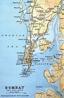
Trombay is an eastern suburb of Mumbai (Bombay), India.
History

Trombay was called Neat's Tongue because of its shape. Once, it was an island nearly 5 km east of Mumbai and was about 8 km in length and 8 km in width. The island contains several ruins of Portuguese churches from the 1620s and 1630s.
In 1928, the Great Indian Peninsular Railway opened the Trombay-Andheri line called the Salsette Trombay Railway or Central Salsette Tramway.