Swainsboro, Georgia
Swainsboro, Georgia | |
|---|---|
 United States Courthouse in Swainsboro
| |
| Nickname: "Crossroads of the Great South"
| |
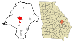 Location in Emanuel County and the state of Georgia
| |
| Coordinates: 32°35′37″N 82°19′56″W | |
| Country | United States |
| State | Georgia |
| County | Emanuel |
| Government | |
| • Mayor | Greg Bennett |
| Area | |
| • Total | 12.94 sq mi (33.52 km2) |
| • Land | 12.58 sq mi (32.58 km2) |
| • Water | 0.36 sq mi (0.94 km2) |
| Elevation | 325 ft (99 m) |
| Population
(2020)
| |
| • Total | 7,425 |
| • Density | 590.27/sq mi (227.91/km2) |
| Time zone | UTC-5 (Eastern (EST)) |
| • Summer (DST) | UTC-4 (EDT) |
| ZIP code | 30401 |
| Area code | 478 |
| FIPS code | 13-74964 |
| GNIS feature ID | 0356574 |
| Website | cityofswainsboro |
Swainsboro is a city in Emanuel County, Georgia, United States. As of the 2020 census, the city had a population of 7,425. The city is the county seat of Emanuel County.
History
In 1822, the Georgia state legislature established "Swainsborough" as the seat of Emanuel County. The town was named in recognition of Stephen Swain, the state senator who introduced the bill for the county's creation in 1812. The town's name was changed to "Paris" at its incorporation on February 18, 1854, but three years later reverted to its current name, Swainsboro.
Transportation
Early in its corporate life, much like other rural Georgia towns, Swainsboro depended on railroads for transportation. However, in the 1930s, many of the town's streets and sidewalks were paved, and Swainsboro found itself at the intersection of two major national highways, U.S. 1 and U.S. 80, thus earning its city motto: "Crossroads of the Great South". U.S. 1 was the principal highway from Maine to Key West, and U.S. 80, at that time, ran from Tybee Island, Georgia, to San Diego.
Geography
Swainsboro is located near the center of Emanuel County at 32°35'37" North, 82°19'56" West (32.593743, -82.332146). U.S. Route 80 passes through the center of the city, and U.S. Route 1 bypasses it to the west. US 80 leads east 36 miles (58 km) to Statesboro and west 36 miles (58 km) to Dublin, while US 1 leads north 62 miles (100 km) to Augusta and south 106 miles (171 km) to Waycross. Interstate 16 is 14 miles (23 km) south of Swainsboro via US 1.
According to the United States Census Bureau, the city has a total area of 12.9 square miles (33.5 km2), of which 12.6 square miles (32.6 km2) is land and 0.35 square miles (0.9 km2), or 2.81%, is water.
Demographics
| Census | Pop. | Note | %± |
|---|---|---|---|
| 1870 | 108 | — | |
| 1880 | 186 | 72.2% | |
| 1890 | 395 | 112.4% | |
| 1900 | 895 | 126.6% | |
| 1910 | 1,313 | 46.7% | |
| 1920 | 1,578 | 20.2% | |
| 1930 | 2,442 | 54.8% | |
| 1940 | 3,575 | 46.4% | |
| 1950 | 4,300 | 20.3% | |
| 1960 | 5,943 | 38.2% | |
| 1970 | 7,325 | 23.3% | |
| 1980 | 7,602 | 3.8% | |
| 1990 | 7,361 | −3.2% | |
| 2000 | 6,943 | −5.7% | |
| 2010 | 7,277 | 4.8% | |
| 2020 | 7,426 | 2.0% | |
| U.S. Decennial Census | |||
| Race | Num. | Perc. |
|---|---|---|
| White (non-Hispanic) | 2,684 | 36.15% |
| Black or African American (non-Hispanic) | 4,180 | 56.3% |
| Native American | 8 | 0.11% |
| Asian | 91 | 1.23% |
| Pacific Islander | 1 | 0.01% |
| Other/Mixed | 183 | 2.46% |
| Hispanic or Latino | 278 | 3.74% |
As of the 2020 United States census, there were 7,425 people, 2,697 households, and 1,783 families residing in the city.
Education
Emanuel County School District
The Emanuel County School District, run by the Emanuel County Board of Education, holds pre-school to grade twelve, and consists of three elementary schools, a middle school, a high school, and two academies. The district has 293 full-time teachers and over 4,664 students.
- Adrian School of Performing Arts (Closed)
- David Emanuel Academy (DEA)
- Swainsboro Elementary School
- Swainsboro Primary School
- Twin City Elementary School
- Swainsboro Middle School
- Emanuel County Institute
- Swainsboro High School
Higher education
- East Georgia State College - Swainsboro Campus
- Southeastern Technical College - Swainsboro Campus
Notable people
- Ray Guy, NFL Hall of Famer, retired punter, three-time Super Bowl champion
- Dwight Howard, NBA Player (born in Swainsboro, raised in Atlanta)
- Rufus Hannah, aka "Rufus the Stunt Bum", born and raised in Swainsboro, famous for his role in the controversial Bumfights series
- Doug Johnson, record producer, songwriter, record label executive, born in Swainsboro
- Pat Mitchell, media personality and businesswoman
- Tony Mitchell, professional basketball player for the Fort Wayne Mad Ants, former Milwaukee Bucks player
- George L. Smith II, member of the Georgia House of Representatives (1944–1973) and Speaker of the same body (1959–1962, 1967–1973)
- Ben Troupe, born in Swainsboro, played high school football in Augusta, former University of Florida football standout
- Larry Jon Wilson, singer-songwriter, born in Swainsboro