Snowy Monaro Regional Council
|
Snowy Monaro Regional Council New South Wales | |||||||||||||||
|---|---|---|---|---|---|---|---|---|---|---|---|---|---|---|---|
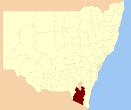 Location in New South Wales
| |||||||||||||||
| Coordinates | 36.232°S 149.130°E / -36.232; 149.130 | ||||||||||||||
| Population |
|
||||||||||||||
| • Density | 1.33347/km2 (3.45366/sq mi) | ||||||||||||||
| Established | 12 May 2016 | ||||||||||||||
| Area | 15,162 km2 (5,854.1 sq mi) | ||||||||||||||
| Mayor | Narelle Davis | ||||||||||||||
| Council seat | Cooma | ||||||||||||||
| Region | |||||||||||||||
| State electorate(s) | Monaro | ||||||||||||||
| Federal division(s) | Eden-Monaro | ||||||||||||||
| |||||||||||||||
The Snowy Monaro Regional Council is a local government area located in the Snowy Mountains and Monaro regions of New South Wales, Australia. The council was formed on 12 May 2016 through a forced merger of the Bombala, Cooma-Monaro and Snowy River shires.
The council comprises an area of 15,162 square kilometres (5,854 sq mi) and occupies the higher slopes of the eastern side of the Great Dividing Range between the Australian Capital Territory to the north and the state boundary with Victoria to the south. At the time of its establishment the council had an estimated population of 20,707. Its population at the 2016 census was 20,218.
The Mayor of the Snowy Monaro Regional Council is Chris Hanna since 21st of September, 2023.
Towns and localities
The following towns are located within Snowy Monaro Regional Council:
The following localities are located within Snowy Monaro Regional Council:
- Ando
- Anembo
- Anglers Reach
- Arable
- Avonside
- Badja
- Beloka
- Bibbenluke
- Billilingra
- Binjura
- Blue Cow
- Bobundara
- Bolaro
- Braemar Bay
- Bredbo
- Buckenderra
- Bumbalong
- Bungarby
- Bunyan
- Burra (part)
- Carlaminda
- Chakola
- Cathcart
- Clear Range
- Colinton
- Coolringdon
- Cootralantra
- Corrowong
- Countegany
- Crackenback
- Craigie
- Creewah
- Dairymans Plains
- Dalgety
- Dangelong
- Dry Plains
- East Jindabyne
- Eucumbene
- Frying Pan
- Glen Allen
- Glen Fergus
- Gooandra
- Greenlands
- Grosses Plain
- Guthega
- Hill Top
- Ingebirah
- Ironmungy
- Jerangle
- Jimenbuen
- Jingera
- Kalkite
- Kiandra
- Kybeyan
- Long Plain
- Lords Hill
- Maffra
- Merriangaah
- Michelago
- Middle Flat
- Middlingbank
- Mila
- Moonbah
- Murrumbucca
- Myalla
- Nimmo
- Numbla Vale
- Numeralla
- Nungar
- Old Adaminaby
- Palarang
- Paupong
- Peak View
- Perisher
- Pine Valley
- Polo Flat
- Quidong
- Rhine Falls
- Rock Flat
- Rockton
- Rocky Plain
- Rose Valley
- Rosemeath
- Shannons Flat
- Smiggin Holes
- Springfield
- Steeple Flat
- Tantangara
- The Angle
- The Brothers
- Thredbo
- Tinderry
- Tolbar
- Tombong
- Tuross
- Wambrook
- Williamsdale (part)
- Winifred
- Yaouk
Heritage listings
The Snowy Monaro Region has a number of heritage-listed sites, including:
- Bombala, Goulburn-Bombala railway: Bombala railway station
- Bombala, 91 Main Road: Crankies Plain Bridge
- Bredbo, Goulburn-Bombala railway: Bredbo Rail Bridge
- Cooma, Bradley Street: Cooma railway station
- Cooma, 59 - 61 Lambie Street: Royal Hotel
- Cooma, Sharp Street: Rock Bolting Development Site
- Eucumbene, Old Adaminaby and Lake Eucumbene
- Kiandra: Kiandra Courthouse
- Kiandra: Matthews Cottage
Demographics
The population for the predecessor councils was estimated in 2013 as:
- 2,401 in Bombala Shire
- 10,073 in Cooma-Monaro Shire and
- 8,087 in Snowy River Shire.
Council
The Snowy Monaro Regional Council comprises eleven Councillors elected proportionally in a single ward. The Councillors elected for a fixed four-year term of office with effect from 4 December 2021 were:
| Councillor | Party | Notes | |
|---|---|---|---|
| Christopher Hanna | Independent | ||
| Tanya Higgins | Labor | Deputy Mayor | |
| Narelle Davis | Independent | Mayor | |
| Tricia Hopkins | Independent | ||
| Karlee Pateman | Independent | ||
| Bob Stewart | Independent | Re-elected | |
| Lynda Summers | Labor | ||
| Luke Williamson | Independent | ||
| Craig Mitchell | Independent | ||
| Peter Beer | Independent | Re-elected | |
| Louise Frolich | Independent | ||