Princess Thyra Island
Native name: Prinsesse Thyra Ø
| |
|---|---|
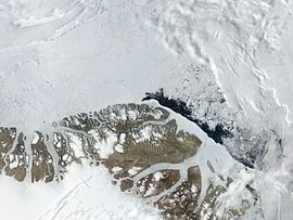 Satellite image of the northern end of Greenland including Princess Thyra Island
| |
|
Map of Princess Thyra Island
| |
 Princess Thyra Island Location of Princess Thyra Island in Greenland
| |
| Etymology | named after Princess Thyra of Denmark |
| Geography | |
| Coordinates | 82°0′N 19°15′W |
| Adjacent to | Wandel Sea |
| Area | 313 km2 (121 sq mi) |
| Area rank | 22nt largest in Greenland |
| Length | 36 km (22.4 mi) |
| Width | 28 km (17.4 mi) |
| Highest elevation | 76 m (249 ft) |
| Administration | |
| Unincorporated area | NE Greenland National Park |
| Demographics | |
| Population | 0 (2022) |
| Pop. density | 0/km2 (0/sq mi) |
| Ethnic groups | none |
Princess Thyra Island (Danish: Prinsesse Thyra Ø) is an uninhabited island of the Wandel Sea, Greenland. The island is within King Frederick VIII Land in the Northeast Greenland National Park. The island was named after Princess Thyra of Denmark.
Geography
This island is located east of Princess Margaret Island, to the northwest of Princess Dagmar Island close to the coast of far northeastern Greenland, in a bay of the Wandel Sea at the confluence of Denmark Sound and Independence Sound.
The island has an area of 313 km ² and a shoreline of 85.7 kilometres. It was formerly part of Avannaa, originally Nordgrønland ("North Greenland"), one of the counties of Greenland until 31 December 2008.
 |
 |