New Bataan
New Bataan | |
|---|---|
| Municipality of New Bataan | |
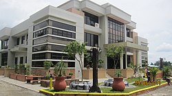 New Bataan Municipal Hall
| |
| Motto: Progress New Bataan
| |
 Map of Davao de Oro with New Bataan highlighted
| |
|
OpenStreetMap
| |
 New Bataan Location within the Philippines
| |
| Coordinates: 7°32′54″N 126°08′17″E | |
| Country | Philippines |
| Region | Davao Region |
| Province | Davao de Oro |
| District | 1st district |
| Founded | June 18, 1968 |
| Named for | Bataan |
| Barangays | 16 (see Barangays) |
| Government | |
| • Type | Sangguniang Bayan |
| • Mayor | Geraldford N. Balbin (PDP–Laban) |
| • Vice Mayor | Larie B. Pagalan (PDP–Laban) |
| • Representative | Ma. Carmen S. Zamora-Apsay |
| • Electorate | 33,558 voters (2022) |
| Area | |
| • Total | 553.15 km2 (213.57 sq mi) |
| Elevation | 752 m (2,467 ft) |
| Highest elevation | 2,664 m (8,740 ft) |
| Lowest elevation | 64 m (210 ft) |
| Population
(2020 census)
| |
| • Total | 51,466 |
| • Density | 93/km2 (240/sq mi) |
| • Households | 12,781 |
| Economy | |
| • Income class | 1st municipal income class |
| • Poverty incidence |
25.60 |
| • Revenue | ₱ 249.4 million (2020) |
| • Assets | ₱ 500.9 million (2020) |
| • Expenditure | ₱ 213.1 million (2020) |
| • Liabilities | ₱ 110.1 million (2020) |
| Service provider | |
| Time zone | UTC+8 (PST) |
| ZIP code | 8804 |
| PSGC | |
| IDD : area code | +63 (0)87 |
| Native languages | Davawenyo Cebuano Kalagan Mansaka Tagalog Ata Manobo |
| Patron saint | San Antonio de Padua |
| Website | www |
New Bataan, officially the Municipality of New Bataan (Cebuano: Lungsod sa Bag-ong Bataan; Tagalog: Bayan ng Bagong Bataan), is a 1st class municipality in the province of Davao de Oro, Philippines. According to the 2020 census, it has a population of 51,466 people. Geraldford N. Balbin has been its mayor since July 2016.
It is about 16 kilometres (9.9 mi) from Compostela, 40 kilometres (25 mi) from the provincial capital Nabunturan, and 75 kilometres (47 mi) from Tagum City. The municipality was founded on 18 June 1968, through Republic Act No. 4756. According to the 2020 census, it has a population of 51,466 people.
The town's festivals include Araw Celebration, held annually on 18 June; Founder's Day, held every 10 August; Sal’lupongan Festival, held every 13 June. Its patron saint is Saint Anthony of Padua.
The municipality was one of the hardest-hit towns of Typhoon Pablo when it hit the town on 4 December 2012.
With then First Lady Luz Banzon-Magsaysay who helped in the approval of the town site reservation in now Barangay Cabinuangan, the municipality got its name in honor to her who came and got prominence in Bataan Province, where also Tagalog settlers in the area came from during Commonwealth and post-World War II periods.
Geography
New Bataan has a total land area of 55,315 hectares (136,690 acres) and is situated north and west of Davao Oriental province; south of Municipality of Compostela and west of Municipality of Maragusan. It is surrounded by mountain ranges, with over 50% of its territory being forest cover that has been the source of livelihood for some people living there. The barangays of New Bataan that are mostly covered with forest are Andap, Tandawan, Camanlangan, Manurigao. Manurigao is the most remote among the barangay because of the absence of a better road and transportation.
The municipality is also watered by various rivers. One of which is the Mayo River that flows from the mountain of Andap and empties into the Agusan River. The Batoto river is also one of the biggest, it flows from the western part of the area. The northwestern portion of the municipality forms part on the contiguous plain of Compostela valley.
Barangays
New Bataan is politically divided into 16 barangays. Each barangay consists of puroks while some have sitios.
- Andap
- Bantacan
- Batinao
- Cabinuangan (Poblacion)
- Camanlangan
- Cogonon
- Fatima
- Kahayag
- Katipunan
- Magangit
- Magsaysay
- Manurigao
- Pagsabangan
- Panag
- San Roque
- Tandawan
Climate
| Climate data for New Bataan | |||||||||||||
|---|---|---|---|---|---|---|---|---|---|---|---|---|---|
| Month | Jan | Feb | Mar | Apr | May | Jun | Jul | Aug | Sep | Oct | Nov | Dec | Year |
| Mean daily maximum °C (°F) | 22 (72) |
22 (72) |
22 (72) |
23 (73) |
24 (75) |
23 (73) |
23 (73) |
23 (73) |
24 (75) |
24 (75) |
23 (73) |
22 (72) |
23 (73) |
| Mean daily minimum °C (°F) | 17 (63) |
17 (63) |
17 (63) |
17 (63) |
18 (64) |
19 (66) |
18 (64) |
18 (64) |
19 (66) |
19 (66) |
18 (64) |
17 (63) |
18 (64) |
| Average precipitation mm (inches) | 194 (7.6) |
173 (6.8) |
139 (5.5) |
122 (4.8) |
236 (9.3) |
305 (12.0) |
249 (9.8) |
211 (8.3) |
214 (8.4) |
257 (10.1) |
241 (9.5) |
181 (7.1) |
2,522 (99.2) |
| Average rainy days | 21.0 | 18.4 | 18.7 | 20.0 | 26.5 | 28.1 | 27.7 | 27.1 | 25.7 | 27.3 | 25.6 | 22.1 | 288.2 |
| Source: Meteoblue (modeled/calculated data, not measured locally) | |||||||||||||
Land classification
- Forest: 33,727.7261 ha (130.223478 sq mi)
- Agro-forest: 2,158.6502 ha (8.334595 sq mi)
- Agricultural: 692.7559 ha (2.674745 sq mi)
- Mining: 6,210.401 ha (23.97849 sq mi)
- Residential: 11.843 ha (0.04573 sq mi)
- Brush land: 2,158.6502 ha (8.334595 sq mi)
- Commercial: 11.5962 ha (0.044773 sq mi)
- Road: 62.06395 ha (0.2396303 sq mi)
- Institutional: 18.91645 ha (0.0730368 sq mi)
- Special use: 3.1605 ha (0.012203 sq mi)
- Industrial: 0.3828 ha (0.001478 sq mi)
- Rivers/canals: 38.3858 ha (0.148208 sq mi)
Demographics
| Year | Pop. | ±% p.a. |
|---|---|---|
| 1970 | 19,978 | — |
| 1975 | 26,637 | +5.94% |
| 1980 | 32,887 | +4.30% |
| 1990 | 39,629 | +1.88% |
| 1995 | 43,327 | +1.69% |
| 2000 | 42,549 | −0.39% |
| 2007 | 45,309 | +0.87% |
| 2010 | 47,470 | +1.71% |
| 2015 | 47,726 | +0.10% |
| 2020 | 51,466 | +1.49% |
| Source: Philippine Statistics Authority | ||
In the 2020 census, the population of New Bataan was 51,466 people, with a density of 93 inhabitants per square kilometre or 240 inhabitants per square mile.
- Birth rate (crude): 28.82 (2005)
- Death rate (crude): 4.12 (2005)
Economy
- Annual local income: P5,761,257.97 (2005)
- Internal revenue allotment: P52,636,316 (2005)
- Major crops
- Coconut
- Rice
- Corn
- Banana
- Coffee/Cacao
- Abaca/Bamboo
Transportation
Road network (within the LGU territory):
- National road: 35.75 kilometres (22.21 mi)
- Provincial road: 40.45 kilometres (25.13 mi)
- Municipal road: 102.50 kilometres (63.69 mi)