National Highway 75 (India)
 | ||||
|---|---|---|---|---|
|
Map of the National Highway in red
| ||||
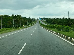 NH 75 route in Karnataka
| ||||
| Route information | ||||
| Length | 533 km (331 mi) | |||
| Major junctions | ||||
| West end | Bantval, Karnataka | |||
| East end | Vellore, Tamil Nadu | |||
| Location | ||||
| Country | India | |||
| States | Karnataka, Andhra pradesh, Tamil Nadu | |||
| Primary destinations |
Uppinangady, Sakleshpur, Hassan, Kunigal, Nelamangala, Bengaluru, Kolar, Mulbagal, Venkatagirikota, Pernambut, Gudiyattam, Katpadi | |||
| Highway system | ||||
| ||||
National Highway 75 (NH 75) is one of major National Highway in India. passing through states of Karnataka, Andhra Pradesh, and Tamil Nadu. This national highway was earlier known as National Highway 48 (NH-48) before rationalisation of highway numbers in 2010. The highway connects the port city of Mangaluru (Mangalore) in the west to the city of Vellore in the east. National highway 75 is the main road for travellers from Mangaluru going to Bengaluru and Hassan. NH-75 traverses all three geographical regions of Karnataka state namely Karavali, Malenadu and Bayaluseeme.
Renamed roads
KA SH 54 (Belur Road), NH 373, NH 69
Route

It starts at Bantwal in Karnataka state and passes through Nellyadi, Shiradi ghat, Sakleshpura, Hassan, Yediyur, Kunigal, Bengaluru, Kolar, Mulbagal, Venkatagirikota, Pernambut, Gudiyattam, Katpadi before terminating at Vellore in Tamil Nadu. This highway bypasses Hassan and Kunigal main town area.
State–wise route length in km.
- Karnataka - 418.7 km (260.2 mi)
- Andhra Pradesh – 23.40 km (14.54 mi)
- Tamil Nadu - 60.7 km (37.7 mi)
Junctions
-
 NH 73 Terminal near Bantwal.
 -
 NH 275 near Bantwal
 -
 NH 373 near Hassan
 -
 NH 150A at Bellur Cross
 -
 NH 48 near Nelamangala
 -
 NH 44 near Hebbal
 -
 NH 340 near Hoskote
 -
 NH 648 near Hoskote
 -
 NH 69 near Mulbagal
 -
 NH 42 near Venkatagirikota
 -
NH 48 Terminal near Vellore.