Nandyal
|
Nandyal
Nandi-Aalayam
| |
|---|---|
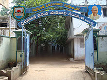
 Nandyal Junction Main Entrance
| |
 Nandyal Location in Andhra Pradesh, India
| |
| Coordinates: 15.48°N 78.48°E / 15.48; 78.48 | |
| Country | India |
| State | Andhra Pradesh |
| District | Nandyal |
| Incorporated (municipality) | 1899 |
| Incorporated (city) | 1991 |
| Government | |
| • Type | Municipal council |
| Area | |
| • City | 33.67 km2 (13.00 sq mi) |
| Elevation | 203 m (666 ft) |
| Population
(2011)
| |
| • City | 211,424 |
| • Rank | 13th (in state) |
| • Density | 6,300/km2 (16,000/sq mi) |
| • Metro | 211,424 |
| Languages | |
| • Official | Telugu |
| Time zone | UTC+5:30 (IST) |
| PIN | 518501,518502 |
| Vehicle registration | AP–21 |
| Website | Nandyal Municipality |
Nandyal is a city and District headquarters of Nandyal district of the Indian state of Andhra Pradesh. It is a municipality and the headquarters of Nandyal mandal in Nandyal revenue division.
Demographics
In the 2011 census of India, Nandyal had a population of 211,424 making it the 13th most populous town in the state.
Governance
Civic administration
Nandyal municipality was constituted in the year 1899. The jurisdictional area is spread over an area of 19 km2 (7.3 sq mi). Its urban agglomeration is spread over an area of 33.67 km2 (13.00 sq mi) which includes constituents of Nandyal municipality, out growths of Moolasagaram, Noonepalle and partial outgrowths of Udumalpuram, Ayyalur.
Culture and tourism
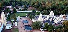
Nandyal is surrounded by nine sacred temples known as the Nava Nandi. Sri Yaganti Uma Maheswara Temple near Nandyal has one of the largest Nandi idols of the world. As per the Archaeological Survey of India, the rock grows at a rate of 1 inch (2.5 cm) per 20 years. Nandyal District also consists of Belum Caves, Mahanandi and Srisailam.
Climate
| Climate data for Nandyal (1981–2010, extremes 1966–2012) | |||||||||||||
|---|---|---|---|---|---|---|---|---|---|---|---|---|---|
| Month | Jan | Feb | Mar | Apr | May | Jun | Jul | Aug | Sep | Oct | Nov | Dec | Year |
| Record high °C (°F) | 37.4 (99.3) |
40.5 (104.9) |
43.0 (109.4) |
46.1 (115.0) |
46.0 (114.8) |
45.4 (113.7) |
41.8 (107.2) |
39.7 (103.5) |
37.9 (100.2) |
38.2 (100.8) |
35.5 (95.9) |
36.8 (98.2) |
46.1 (115.0) |
| Mean daily maximum °C (°F) | 31.8 (89.2) |
34.8 (94.6) |
38.0 (100.4) |
40.3 (104.5) |
40.6 (105.1) |
37.1 (98.8) |
34.4 (93.9) |
33.2 (91.8) |
33.0 (91.4) |
32.5 (90.5) |
31.3 (88.3) |
30.5 (86.9) |
34.8 (94.6) |
| Mean daily minimum °C (°F) | 15.9 (60.6) |
19.1 (66.4) |
22.2 (72.0) |
25.6 (78.1) |
27.4 (81.3) |
25.9 (78.6) |
24.7 (76.5) |
24.3 (75.7) |
24.3 (75.7) |
23.1 (73.6) |
20.5 (68.9) |
16.5 (61.7) |
22.5 (72.4) |
| Record low °C (°F) | 9.2 (48.6) |
12.0 (53.6) |
12.2 (54.0) |
18.5 (65.3) |
17.1 (62.8) |
17.5 (63.5) |
18.2 (64.8) |
18.5 (65.3) |
16.1 (61.0) |
10.5 (50.9) |
12.7 (54.9) |
9.6 (49.3) |
9.2 (48.6) |
| Average rainfall mm (inches) | 1.3 (0.05) |
0.9 (0.04) |
3.8 (0.15) |
11.6 (0.46) |
50.7 (2.00) |
93.1 (3.67) |
159.5 (6.28) |
155.7 (6.13) |
159.9 (6.30) |
123.2 (4.85) |
26.5 (1.04) |
2.9 (0.11) |
789.1 (31.07) |
| Average rainy days | 0.0 | 0.3 | 0.4 | 1.0 | 2.9 | 5.6 | 8.4 | 8.9 | 8.0 | 6.1 | 2.2 | 0.5 | 44.2 |
| Average relative humidity (%) (at 17:30 IST) | 45 | 39 | 33 | 32 | 35 | 48 | 57 | 60 | 64 | 67 | 63 | 56 | 50 |
| Source: India Meteorological Department | |||||||||||||
Economy
The city is a major hub of industry and agriculture. It is rich in natural resources like marble. There are many rice mills and oil mills and Cotton mills and industries which produce milk, soft drinks, sugar, PVC pipes, etc. Some of the renowned industries in the City are the Vijaya Dairy, Nandi Dairy, Nandi Pipes, Nandi Polymers, S. P. Y. Agro, Nandi Steels, etc.
Transport
The Andhra Pradesh State Road Transport Corporation operates bus services from Nandyal bus station. Nandyal Junction Railway Station is administered under Guntur railway division of South Central Railways. Kurnool Airport is 50 km from Nandyal.
Education
The primary and secondary school education is imparted by government, aided and private schools, under the School Education Department of the state.