Mount Kirigamine
| Mount Kirigamine | |
|---|---|
| 霧ヶ峰 | |
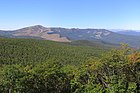
 Kirigamine seen from the east. Taken from Mount Tateshina.
| |
| Highest point | |
| Elevation | 1,925 m (6,316 ft) |
| Coordinates | 36°06′00″N 138°10′01″E |
| Geography | |
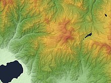
 Mount Kirigamine Location of Mount Kirigamine in Japan.
 Mount Kirigamine Mount Kirigamine (Japan)
| |
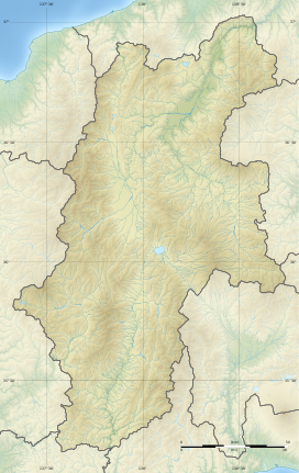
| Location | Nagano Prefecture, Japan |
| Geology | |
| Mountain type | Lava flow, Lava dome |
| Last eruption | 0.75 Ma |
Mount Kirigamine (霧ヶ峰, Kiri-ga-mine) is a 1,925m volcano, located in Nagano Prefecture, Japan.
Outline
The tallest peak of Mount Kirigamine is Mount Kuruma, on which there is a weather radar site. Most of the mountain is covered in grass with sparse bushes and rocks. The south and east sides are suitable for gliding with a narrow landing zone in the vicinity of a parking lot and a huge emergency landing at the west side of the mountain. The southeast cliffs are a launching point for gliders, with winds above 3 meters. The north part is equipped with ski lifts.
Access
Vehicle access to the bottom of Kirigamine does not require four-wheel drive but snow chains may be necessary if there is heavy snow.
Gallery
-
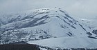 Mount Kuruma is a tallest peak
 -
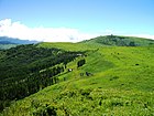 Mount Kuruma from Mount Minaminomimi
 -
 Kirigamine seen from the east.
 -
 Mount Kirigamine and Yashimagahara Wetland
 -
 A weather radar site on the top of Mount Kuruma


