Melville Island (Northwest Territories and Nunavut)
 NASA satellite photograph of Melville Island
| |
 | |
 Melville Island  Melville Island  Melville Island | |
| Etymology | The Viscount Melville |
|---|---|
| Geography | |
| Location | Canadian Arctic |
| Coordinates | 75°30′02″N 111°30′09″W |
| Archipelago | Queen Elizabeth Islands |
| Adjacent to | |
| Area | 42,149 km2 (16,274 sq mi) |
| Area rank | 33rd |
| Length | 341 km (211.9 mi) |
| Width | 210–292 km (130–181 mi) |
| Highest elevation | 762 m (2500 ft) |
| Administration | |
Canada | |
| Territories | Northwest Territories, Nunavut |
| Regions | Qikiqtaaluk, Inuvik |
| Demographics | |
| Population | 0 (uninhabited) (2024) |
Melville Island (French: île Melville; Inuktitut: ᐃᓗᓪᓕᖅ, Ilulliq) is an uninhabited member of the Queen Elizabeth Islands of the Arctic Archipelago. With an area of 42,149 km2 (16,274 sq mi), It is the 33rd largest island in the world and Canada's eighth largest island.
Mountains on Melville Island, some of the largest in the western Canadian Arctic, reach heights of 750 m (2,460 ft). There are two subnational pene-exclaves that lie west of the 110th meridian and form part of the Northwest Territories. These can only be reached by land from Nunavut or boat from the Northwest Territories.
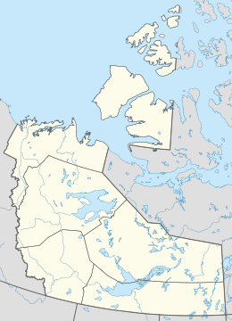
Melville Island is shared by the Northwest Territories, which is responsible for the western half of the island, and Nunavut, which is responsible for the eastern half. The border runs along the 110th meridian west.
Geography
The island is located between Prince Patrick Island in the northwest, Eglinton Island in the west, and Byam Martin Island in the east. Across Viscount Melville Sound in the south lies Victoria Island.
The island has little or no vegetation. Where continuous vegetation occurs, it usually consists of hummocks of mosses, lichens, grasses, and sedges. The only woody species, the dwarf willow, grows as a dense twisted mat crawling along the ground.
Ibbett Bay is a fjord on the western side of the island, running approximately 55 km long.
Fauna
A diverse animal population exists: polar bear, Peary caribou, muskox, northern collared lemming, Arctic wolf, Arctic fox, Arctic hare, and ermine (stoat) are common. A 2003 sighting of a grizzly bear and grizzly tracks by an expedition from the University of Alberta represent the most northerly reports of grizzly bears ever recorded.
Melville Island is one of two major breeding grounds for the brant goose. DNA analysis and field observations suggest that these birds may be distinct from other brant stocks. Numbering 4,000–8,000 birds, this could be one of the rarest goose stocks in the world.
History
The first documented European to visit Melville Island was the British explorer, Sir William Parry, in 1819. He was forced to spend the winter at what is now called "Winter Harbour," until 1 August 1820, owing to freeze-up of the sea.
The island is named for Robert Dundas, 2nd Viscount Melville, who was First Sea Lord at the time. In the search for Franklin's lost expedition, its east coast was explored as far as Bradford Point by Abraham Bradford in 1851, while its north and west coasts were surveyed by Francis Leopold McClintock, Richard Vesey Hamilton, and George Henry Richards in 1853.
On January 30, 1920, The Pioche Record reported that Icelandic explorer Vilhjalmur Stefansson discovered a lost cache from the 1853 McClintock expedition on Melville Island. Clothing and food from the cache was in excellent condition despite the harsh arctic conditions.
In 1930, a large sandstone rock marking Parry's 1819 wintering site at Winter Harbour, approximately five point five metres (18 ft) long and three metres (10 ft) high, was designated a National Historic Site of Canada.
Fossil fuel deposits
Melville has surfaced as a candidate for natural gas deposits. The island was believed to have deposits of coal and oil shale since the first half of the 20th century. The first Canadian Arctic island exploratory well was spudded in 1961 at Winter Harbour.
It drilled Lower Paleozoic strata to a total depth of 3,823 metres (12,543 ft). In the 1970s, the northern portion of the island on the east side of the Sabine Peninsula proved to contain a major gas field, known as Drake Point. The lease was owned by Panarctic Oils, a joint operation with the Canadian Government.