Maragusan
|
Maragusan
San Mariano
| |
|---|---|
| Municipality of Maragusan | |
 Flag
| |
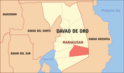 Map of Davao de Oro with Maragusan highlighted
| |
|
OpenStreetMap
| |
 Maragusan Location within the Philippines
| |
| Coordinates: 7°19′01″N 126°07′26″E | |
| Country | Philippines |
| Region | Davao Region |
| Province | Davao de Oro |
| District | 1st district |
| Barangays | 24 (see Barangays) |
| Government | |
| • Type | Sangguniang Bayan |
| • Mayor | Lito Cabalquinto |
| • Vice Mayor | Cesar C. Colina Sr. |
| • Representative | Manuel E. Zamora |
| • Electorate | 42,770 voters (2022) |
| Area | |
| • Total | 394.27 km2 (152.23 sq mi) |
| Elevation | 813 m (2,667 ft) |
| Highest elevation | 1,544 m (5,066 ft) |
| Lowest elevation | 615 m (2,018 ft) |
| Population
(2020 census)
| |
| • Total | 64,412 |
| • Density | 160/km2 (420/sq mi) |
| • Households | 16,002 |
| Economy | |
| • Income class | 1st municipal income class |
| • Poverty incidence |
22.74 |
| • Revenue | ₱ 284 million (2020) |
| • Assets | ₱ 454.8 million (2020) |
| • Expenditure | ₱ 217.3 million (2020) |
| • Liabilities | ₱ 56.29 million (2020) |
| Service provider | |
| • Electricity | Davao del Norte Electric Cooperative (DANECO) |
| Time zone | UTC+8 (PST) |
| ZIP code | 8808 |
| PSGC | |
| IDD : area code | +63 (0)87 |
| Native languages | Davawenyo Cebuano Kalagan Mansaka Tagalog Ata Manobo |
| Website | www |
Maragusan, officially the Municipality of Maragusan (Cebuano: Lungsod sa Maragusan; Tagalog: Bayan ng Maragusan), is a 1st class municipality in the province of Davao de Oro, Philippines. According to the 2020 census, it has a population of 64,412 people.
History
The area in what is now Maragusan is a valley that in the past were inhabited solely by native Mansakan people who made their living by engaging in slash-and-burn agricultural practices. They identified themselves as “Man-Agusan” which means those living on the banks of the Agusan River which had its source within the boundaries of the present municipality.
The area which is now Maragusan was made part of the municipality of Doña Alicia which was created in May 28, 1953 by virtue of Executive Order No. 596 of Pres. Elpidio Quirino, which was renamed Mabini a year later. By the time the town was created with which the area became part of, the valley remained undiscovered by settlers until in 1955 a pilot and a rancher from Lake Leonard discovered it by accident while travelling off-course. This triggered the creation of an agricultural settlement located in the Aguakan Springs which is now the location of the town center. The name of the settlement gradually became "Maragusan" which is a corruption of the “Man-Agusan” which was how the Mansakan natives of the area referred to themselves.
Maragusan eventually became a barangay of Mabini of in 1962. But while it grew as an agricultural settlement located in a valley, it had no direct route to Mabini's town center or government facilities. Hence, as early as 1972, locals have been clamoring for the establishment of a municipality in the area. A proposal to name it "San Mariano" was made, named after Mariano Marcos who is the father of Pres. Ferdinand Marcos who governed the Philippines during this time, to expedite its creation. Finally, on November 25, 1977, the municipality of San Mariano was created under Presidential Decree No. 1247 signed by Pres. Marcos himself, with the barangay of Maragusan made as seat of local government. After the ouster of Marcos in 1986, the municipality of San Mariano was officially renamed Maragusan in October 12, 1988.
Geography
Barangays
Maragusan is politically subdivided into 24 barangays. Each barangay consists of puroks while some have sitios.
- Bagong Silang
- Mapawa
- Maragusan (Poblacion)
- New Albay
- Tupaz
- Bahi
- Cambagang
- Coronobe
- Katipunan
- Lahi
- Langgawisan
- Mabugnao
- Magcagong
- Mahayahay
- Mauswagon
- New Katipunan
- New Manay
- New Panay
- Paloc
- Pamintaran
- Parasanon
- Talian
- Tandik
- Tigbao
Climate
| Climate data for Maragusan | |||||||||||||
|---|---|---|---|---|---|---|---|---|---|---|---|---|---|
| Month | Jan | Feb | Mar | Apr | May | Jun | Jul | Aug | Sep | Oct | Nov | Dec | Year |
| Mean daily maximum °C (°F) | 23 (73) |
23 (73) |
24 (75) |
25 (77) |
25 (77) |
24 (75) |
24 (75) |
24 (75) |
25 (77) |
25 (77) |
24 (75) |
24 (75) |
24 (75) |
| Mean daily minimum °C (°F) | 17 (63) |
17 (63) |
17 (63) |
18 (64) |
19 (66) |
19 (66) |
19 (66) |
19 (66) |
19 (66) |
19 (66) |
18 (64) |
18 (64) |
18 (65) |
| Average precipitation mm (inches) | 137 (5.4) |
114 (4.5) |
124 (4.9) |
109 (4.3) |
230 (9.1) |
303 (11.9) |
235 (9.3) |
216 (8.5) |
214 (8.4) |
237 (9.3) |
210 (8.3) |
132 (5.2) |
2,261 (89.1) |
| Average rainy days | 15.8 | 13.8 | 14.9 | 17.4 | 26.7 | 28.4 | 28.0 | 27.6 | 26.2 | 27.5 | 24.4 | 18.3 | 269 |
| Source: Meteoblue | |||||||||||||
Demographics
| Year | Pop. | ±% p.a. |
|---|---|---|
| 1980 | 20,220 | — |
| 1990 | 40,982 | +7.32% |
| 1995 | 40,834 | −0.07% |
| 2000 | 45,937 | +2.56% |
| 2007 | 51,547 | +1.60% |
| 2010 | 55,503 | +2.73% |
| 2015 | 60,842 | +1.76% |
| 2020 | 64,412 | +1.13% |
| Source: Philippine Statistics Authority | ||
In the 2020 census, the population of Maragusan was 64,412 people, with a density of 160 inhabitants per square kilometre or 410 inhabitants per square mile. It ranks 3rd most populated municipality in the first district of Davao de Oro.
Economy