Limasawa
|
Limasawa
Mazaua
| |
|---|---|
| Municipality of Limasawa | |
 Flag
 Seal
| |
| Nickname: "The First Mass Site in the Philippines"
| |
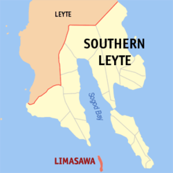 Map of Southern Leyte with Limasawa highlighted
| |
|
OpenStreetMap
| |
 Limasawa Location within the Philippines
| |
| Coordinates: 9°54′28″N 125°04′30″E | |
| Country | Philippines |
| Region | Eastern Visayas |
| Province | Southern Leyte |
| District | 1st district |
| Founded | June 11, 1978 (Completely became official on August 27, 1989) |
| Barangays | 6 (see Barangays) |
| Government | |
| • Type | Sangguniang Bayan |
| • Mayor | Melchor P. Petracorta (Lakas) |
| • Vice Mayor | Ritche L. Salomon (Lakas) |
| • Representative | Luz V. Mercado |
| • Municipal Council | Members |
| • Electorate | 4,407 voters (2022) |
| Area | |
| • Total | 6.98 km2 (2.69 sq mi) |
| Elevation | 13 m (43 ft) |
| Highest elevation | 848 m (2,782 ft) |
| Lowest elevation | 0 m (0 ft) |
| Population
(2020 census)
| |
| • Total | 6,191 |
| • Density | 890/km2 (2,300/sq mi) |
| • Households | 1,491 |
| Economy | |
| • Income class | 6th municipal income class |
| • Poverty incidence |
22.48 |
| • Revenue | ₱ 57.98 million (2020) |
| • Assets | ₱ 214.1 million (2020) |
| • Expenditure | ₱ 59.73 million (2020) |
| • Liabilities | ₱ 58.3 million (2020) |
| Service provider | |
| • Electricity | Southern Leyte Electric Cooperative (SOLECO) |
| Time zone | UTC+8 (PST) |
| ZIP code | 6605 |
| PSGC | |
| IDD : area code | +63 (0)53 |
| Native languages | Boholano dialect Cebuano Tagalog |
Limasawa, officially the Municipality of Limasawa (Cebuano: Lungsod sa Limasawa; Filipino: Bayan ng Limasawa), is an island municipality in the province of Southern Leyte, Philippines. According to the 2020 census, it has a population of 6,191 people.
History
Within the Philippines, Limasawa is famed as the Mazaua mentioned by Antonio Pigafetta. This was the site of Ferdinand Magellan's initial landing in the area during the Victoria's circumnavigation of the world. After his interpreter slave Enrique had spoken with the locals, Father Pedro de Valderrama performed the first mass in the Philippines on Easter Sunday 31 March 1521.
At the request of the residents of the island of Limasawa, the six barangays that comprise that island were detached and separated from the municipality of Padre Burgos through Presidential Decree No. 1549, signed by then President Ferdinand Marcos on June 11, 1978, and constituted as the Municipality of Limasawa. Limasawa completely became a municipality on August 27, 1989, after then President Corazon Aquino ordered the plebiscite which its residents voted in favor of the creation. The island, also known as Sarangani Island, is located south of Leyte, in the Mindanao or Bohol Sea. It is about 10 kilometres (6.2 mi) long from north to south and is the smallest municipality in the province, in both area and population.
Geography
Barangays
Limasawa is politically subdivided into 6 barangays. Each barangay consists of puroks and some have sitios.
- Cabulihan
- Lugsongan
- Magallanes (Poblacion)
- San Agustin (Tawid)
- San Bernardo (Tigib)
- Trianas
Climate
| Climate data for Limasawa, Southern Leyte | |||||||||||||
|---|---|---|---|---|---|---|---|---|---|---|---|---|---|
| Month | Jan | Feb | Mar | Apr | May | Jun | Jul | Aug | Sep | Oct | Nov | Dec | Year |
| Mean daily maximum °C (°F) | 27 (81) |
28 (82) |
29 (84) |
30 (86) |
31 (88) |
30 (86) |
29 (84) |
30 (86) |
30 (86) |
29 (84) |
28 (82) |
28 (82) |
29 (84) |
| Mean daily minimum °C (°F) | 22 (72) |
22 (72) |
22 (72) |
23 (73) |
24 (75) |
24 (75) |
23 (73) |
23 (73) |
23 (73) |
23 (73) |
23 (73) |
23 (73) |
23 (73) |
| Average precipitation mm (inches) | 98 (3.9) |
82 (3.2) |
96 (3.8) |
71 (2.8) |
104 (4.1) |
129 (5.1) |
101 (4.0) |
94 (3.7) |
99 (3.9) |
135 (5.3) |
174 (6.9) |
143 (5.6) |
1,326 (52.3) |
| Average rainy days | 18.0 | 14.1 | 17.1 | 16.8 | 23.7 | 25.7 | 25.8 | 23.3 | 24.4 | 25.9 | 24.0 | 20.6 | 259.4 |
| Source: Meteoblue | |||||||||||||
Demographics
| Year | Pop. | ±% p.a. |
|---|---|---|
| 1990 | 4,519 | — |
| 1995 | 4,927 | +1.63% |
| 2000 | 5,157 | +0.98% |
| 2007 | 5,831 | +1.71% |
| 2010 | 5,835 | +0.02% |
| 2015 | 6,061 | +0.73% |
| 2020 | 6,191 | +0.42% |
| Source: Philippine Statistics Authority | ||
Economy