Lamballe-Armor
Lamballe-Armor | |
|---|---|
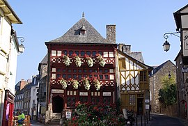 The Lamballe Museum
| |
|
Location of Lamballe-Armor
| |
 Lamballe-Armor  Lamballe-Armor | |
| Coordinates: 48°28′10″N 2°31′00″W | |
| Country | France |
| Region | Brittany |
| Department | Côtes-d'Armor |
| Arrondissement | Saint-Brieuc |
| Canton | Lamballe-Armor and Pléneuf-Val-André |
| Intercommunality | CA Lamballe Terre et Mer |
| Government | |
| • Mayor (2020–2026) | Philippe Hercouët |
| Area 1
|
130.65 km2 (50.44 sq mi) |
| Population
(Jan. 2021)
|
16,845 |
| • Density | 130/km2 (330/sq mi) |
| Time zone | UTC+01:00 (CET) |
| • Summer (DST) | UTC+02:00 (CEST) |
| INSEE/Postal code |
22093 /22400 |
| Elevation | 0–131 m (0–430 ft) |
| 1 French Land Register data, which excludes lakes, ponds, glaciers > 1 km2 (0.386 sq mi or 247 acres) and river estuaries. | |
Lamballe-Armor (French pronunciation: [lɑ̃bal aʁmɔʁ]) is a commune in the Côtes-d'Armor department in Brittany in northwestern France. It was established on 1 January 2019 by merger of the former communes of Lamballe (the seat), Morieux and Planguenoual.
Population
| Year | Pop. | ±% p.a. |
|---|---|---|
| 1968 | 11,638 | — |
| 1975 | 11,799 | +0.20% |
| 1982 | 12,195 | +0.47% |
| 1990 | 12,732 | +0.54% |
| 1999 | 13,578 | +0.72% |
| 2007 | 14,782 | +1.07% |
| 2012 | 16,405 | +2.11% |
| 2017 | 16,578 | +0.21% |
| Populations of the area corresponding with the commune of Lamballe-Armor at 1 January 2020. Source: INSEE | ||