Lamar County, Georgia
Lamar County | |
|---|---|
 Lamar County courthouse in Barnesville
| |
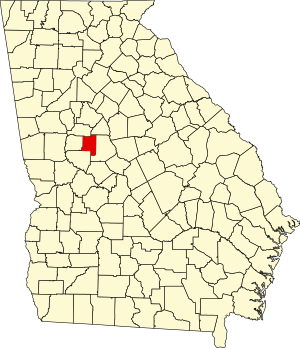 Location within the U.S. state of Georgia
| |
 Georgia's location within the U.S.
| |
| Coordinates: 33°04′N 84°08′W | |
| Country | United States |
| State | Georgia |
| Founded | 1920 |
| Named for | Lucius Quintus Cincinnatus Lamar II |
| Seat | Barnesville |
| Largest city | Barnesville |
| Area | |
| • Total | 186 sq mi (480 km2) |
| • Land | 184 sq mi (480 km2) |
| • Water | 2.3 sq mi (6 km2) 1.3% |
| Population
(2020)
| |
| • Total | 18,500 |
| • Density | 101/sq mi (39/km2) |
| Time zone | UTC−5 (Eastern) |
| • Summer (DST) | UTC−4 (EDT) |
| Congressional district | 3rd |
| Website | www |
Lamar County is a county located in the west central portion of the U.S. state of Georgia. As of the 2020 census, the population was 18,500. The county seat is Barnesville.
History
The Georgia General Assembly proposed the constitutional amendment to create the county on August 17, 1920, and the citizens of the state voted in favor of the amendment on November 2, 1920. Land from Pike County and Monroe County was then transferred to create Lamar County. Lamar County was named after Confederate Democrat white supremacist Lucius Quintus Cincinnatus Lamar II.
Geography
According to the U.S. Census Bureau, the county has a total area of 186 square miles (480 km2), of which 184 square miles (480 km2) is land and 2.3 square miles (6.0 km2) (1.3%) is water. It is located in the Piedmont region of the state.
The western third of Lamar County, west of a line from Orchard Hill through Milner and Barnesville, is located in the Upper Flint River sub-basin of the ACF River Basin (Apalachicola-Chattahoochee-Flint River Basin). The eastern majority of the county is located in the Upper Ocmulgee River sub-basin of the Altamaha River basin.
Major highways
-
 Interstate 75
-
 U.S. Route 41
-
 U.S. Route 341
-
 State Route 7
-
 State Route 18
-
 State Route 36
-
 State Route 109
-
 State Route 401 (unsigned designation for I-75)
Adjacent counties
- Butts County (northeast)
- Monroe County (east)
- Upson County (southwest)
- Pike County (west)
- Spalding County (northwest)
Demographics
| Census | Pop. | Note | %± |
|---|---|---|---|
| 1930 | 9,745 | — | |
| 1940 | 10,091 | 3.6% | |
| 1950 | 10,242 | 1.5% | |
| 1960 | 10,240 | 0.0% | |
| 1970 | 10,688 | 4.4% | |
| 1980 | 12,215 | 14.3% | |
| 1990 | 13,038 | 6.7% | |
| 2000 | 15,912 | 22.0% | |
| 2010 | 18,317 | 15.1% | |
| 2020 | 18,500 | 1.0% | |
| U.S. Decennial Census 1790-1960 1900-1990 1990-2000 2010-2013 | |||
2000 census
As of the census of 2000, there were 15,912 people, 5,712 households, and 4,284 families living in the county. The population density was 86 inhabitants per square mile (33/km2). There were 6,145 housing units at an average density of 33 per square mile (13/km2). The racial makeup of the county was 67.78% White, 30.39% Black or African American, 0.28% Native American, 0.37% Asian, 0.01% Pacific Islander, 0.28% from other races, and 0.89% from two or more races. 1.08% of the population were Hispanic or Latino of any race.
There were 5,712 households, out of which 32.20% had children under the age of 18 living with them, 54.00% were married couples living together, 16.30% had a female householder with no husband present, and 25.00% were non-families. 21.60% of all households were made up of individuals, and 8.90% had someone living alone who was 65 years of age or older. The average household size was 2.64 and the average family size was 3.05.
In the county, the population was spread out, with 24.50% under the age of 18, 11.40% from 18 to 24, 27.90% from 25 to 44, 23.60% from 45 to 64, and 12.60% who were 65 years of age or older. The median age was 36 years. For every 100 females, there were 91.90 males. For every 100 females age 18 and over, there were 88.90 males.
The median income for a household in the county was $37,087, and the median income for a family was $43,481. Males had a median income of $29,453 versus $21,933 for females. The per capita income for the county was $16,666. About 8.10% of families and 11.20% of the population were below the poverty line, including 14.50% of those under age 18 and 11.00% of those age 65 or over.
2010 census
As of the 2010 United States Census, there were 18,317 people, 6,618 households, and 4,617 families living in the county. The population density was 99.8 inhabitants per square mile (38.5/km2). There were 7,474 housing units at an average density of 40.7 per square mile (15.7/km2). The racial makeup of the county was 66.0% white, 30.8% black or African American, 0.4% Asian, 0.3% American Indian, 0.8% from other races, and 1.7% from two or more races. Those of Hispanic or Latino origin made up 1.9% of the population. In terms of ancestry, 20.0% were American, 11.8% were English, 8.8% were Irish, and 6.0% were German.
Of the 6,618 households, 31.9% had children under the age of 18 living with them, 49.0% were married couples living together, 15.7% had a female householder with no husband present, 30.2% were non-families, and 25.6% of all households were made up of individuals. The average household size was 2.55 and the average family size was 3.04. The median age was 37.7 years.
The median income for a household in the county was $37,536 and the median income for a family was $42,218. Males had a median income of $37,535 versus $30,123 for females. The per capita income for the county was $17,725. About 19.4% of families and 20.4% of the population were below the poverty line, including 23.9% of those under age 18 and 17.4% of those age 65 or over.
2020 census
| Race | Num. | Perc. |
|---|---|---|
| White (non-Hispanic) | 12,344 | 66.72% |
| Black or African American (non-Hispanic) | 4,888 | 26.42% |
| Native American | 13 | 0.07% |
| Asian | 102 | 0.55% |
| Pacific Islander | 4 | 0.02% |
| Other/Mixed | 674 | 3.64% |
| Hispanic or Latino | 475 | 2.57% |
As of the 2020 United States census, there were 18,500 people, 6,494 households, and 3,746 families residing in the county.
Communities
- Aldora
- Barnesville (county seat)
- Milner
Politics
| Year | Republican | Democratic | Third party | |||
|---|---|---|---|---|---|---|
| No. | % | No. | % | No. | % | |
| 2020 | 6,331 | 69.99% | 2,620 | 28.97% | 94 | 1.04% |
| 2016 | 5,190 | 67.87% | 2,270 | 29.68% | 187 | 2.45% |
| 2012 | 4,899 | 64.36% | 2,602 | 34.18% | 111 | 1.46% |
| 2008 | 4,873 | 63.24% | 2,752 | 35.72% | 80 | 1.04% |
| 2004 | 4,027 | 61.96% | 2,432 | 37.42% | 40 | 0.62% |
| 2000 | 2,912 | 55.68% | 2,194 | 41.95% | 124 | 2.37% |
| 1996 | 1,988 | 43.75% | 2,125 | 46.76% | 431 | 9.49% |
| 1992 | 1,707 | 38.71% | 2,065 | 46.83% | 638 | 14.47% |
| 1988 | 2,035 | 57.83% | 1,416 | 40.24% | 68 | 1.93% |
| 1984 | 2,198 | 57.80% | 1,605 | 42.20% | 0 | 0.00% |
| 1980 | 1,298 | 33.91% | 2,453 | 64.08% | 77 | 2.01% |
| 1976 | 847 | 23.32% | 2,785 | 76.68% | 0 | 0.00% |
| 1972 | 1,844 | 73.47% | 666 | 26.53% | 0 | 0.00% |
| 1968 | 575 | 20.50% | 790 | 28.16% | 1,440 | 51.34% |
| 1964 | 1,570 | 50.30% | 1,548 | 49.60% | 3 | 0.10% |
| 1960 | 479 | 26.00% | 1,363 | 74.00% | 0 | 0.00% |
| 1956 | 555 | 26.61% | 1,531 | 73.39% | 0 | 0.00% |
| 1952 | 429 | 21.66% | 1,552 | 78.34% | 0 | 0.00% |
| 1948 | 164 | 12.92% | 909 | 71.63% | 196 | 15.45% |
| 1944 | 143 | 12.35% | 1,015 | 87.65% | 0 | 0.00% |
| 1940 | 85 | 8.86% | 869 | 90.62% | 5 | 0.52% |
| 1936 | 69 | 7.59% | 839 | 92.30% | 1 | 0.11% |
| 1932 | 33 | 4.38% | 714 | 94.69% | 7 | 0.93% |
| 1928 | 126 | 15.79% | 672 | 84.21% | 0 | 0.00% |
| 1924 | 38 | 5.72% | 594 | 89.46% | 32 | 4.82% |