Donghae City
|
Donghae
동해시
| |
|---|---|
| Korean transcription(s) | |
| • Hangul | 동해시 |
| • Hanja | 東海市 |
| • Revised Romanization | Donghae-si |
| • McCune-Reischauer | Tonghae-si |
 | |
 Flag
| |
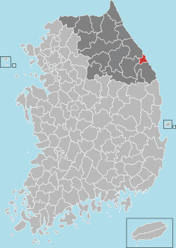 Location in South Korea
| |
| Coordinates: 37°31′29″N 129°06′51″E | |
| Country | South Korea |
| Region | Gwandong |
| First official recorded | 102 AD |
| City established | April 1, 1980 |
| Administrative divisions | 10 dong |
| Government | |
| • mayor | Kyu eon Sim (심규언) |
| Area | |
| • Total | 180.01 km2 (69.50 sq mi) |
| Population
(October, 2022)
| |
| • Total | 89,421 |
| • Density | 521.61/km2 (1,351.0/sq mi) |
| • Dialect | Gangwon |
| Area code | +82-33 |
| Climate | Cfa |
Donghae (Korean: 동해; Korean pronunciation: [to̞ŋ.ɦɛ̝]) is a city in Gangwon Province, South Korea. There are two major ports: Donghae Harbor and Mukho Harbor. The city is located on the Yeongdong Line railroad and the Donghae Expressway. Numerous caverns are found in the city, as in neighboring Samcheok. Hanzhong University was located here.
Location
Donghae is located in the central region of the east coast of Korea in Gangwon-do. Jeongseon county to the west and Gangneung city to the north. It contains the southern terminus of the Donghae Expressway, and the No. 7 national way passes through the city.
The city is mostly mountainous and has natural resources such as Mureung Valley and beautiful beaches. Here, the high Taebaek Mountains lie along the eastern coast, preventing rivers from meeting the coast. However, in the rainy season, spontaneous water flow is possible.
Climate
| Climate data for Donghae (1993–2020 normals, extremes 1992–present) | |||||||||||||
|---|---|---|---|---|---|---|---|---|---|---|---|---|---|
| Month | Jan | Feb | Mar | Apr | May | Jun | Jul | Aug | Sep | Oct | Nov | Dec | Year |
| Record high °C (°F) | 16.1 (61.0) |
23.7 (74.7) |
26.9 (80.4) |
32.6 (90.7) |
33.5 (92.3) |
35.2 (95.4) |
37.1 (98.8) |
37.0 (98.6) |
34.2 (93.6) |
29.7 (85.5) |
24.4 (75.9) |
18.4 (65.1) |
37.1 (98.8) |
| Mean daily maximum °C (°F) | 5.4 (41.7) |
7.0 (44.6) |
11.2 (52.2) |
16.7 (62.1) |
21.1 (70.0) |
23.4 (74.1) |
26.6 (79.9) |
27.6 (81.7) |
23.8 (74.8) |
19.7 (67.5) |
13.7 (56.7) |
7.7 (45.9) |
17.0 (62.6) |
| Daily mean °C (°F) | 1.1 (34.0) |
2.8 (37.0) |
6.8 (44.2) |
12.2 (54.0) |
16.6 (61.9) |
19.6 (67.3) |
23.2 (73.8) |
24.1 (75.4) |
19.8 (67.6) |
15.1 (59.2) |
9.3 (48.7) |
3.4 (38.1) |
12.8 (55.0) |
| Mean daily minimum °C (°F) | −2.8 (27.0) |
−1.4 (29.5) |
2.4 (36.3) |
7.7 (45.9) |
12.5 (54.5) |
16.5 (61.7) |
20.5 (68.9) |
21.1 (70.0) |
16.2 (61.2) |
10.7 (51.3) |
5.0 (41.0) |
−0.8 (30.6) |
9.0 (48.2) |
| Record low °C (°F) | −14.0 (6.8) |
−13.7 (7.3) |
−6.9 (19.6) |
−1.4 (29.5) |
3.5 (38.3) |
6.0 (42.8) |
12.2 (54.0) |
14.4 (57.9) |
8.3 (46.9) |
−0.1 (31.8) |
−6.2 (20.8) |
−11.9 (10.6) |
−14.0 (6.8) |
| Average precipitation mm (inches) | 46.4 (1.83) |
44.0 (1.73) |
57.6 (2.27) |
72.3 (2.85) |
63.3 (2.49) |
105.9 (4.17) |
230.8 (9.09) |
227.2 (8.94) |
219.8 (8.65) |
102.9 (4.05) |
71.6 (2.82) |
22.5 (0.89) |
1,264.3 (49.78) |
| Average precipitation days (≥ 0.1 mm) | 5.6 | 6.1 | 8.5 | 8.3 | 8.8 | 10.7 | 14.4 | 14.8 | 12.1 | 7.9 | 7.3 | 4.1 | 108.6 |
| Average snowy days | 5.1 | 4.0 | 3.4 | 0.2 | 0.0 | 0.0 | 0.0 | 0.0 | 0.0 | 0.0 | 0.4 | 1.4 | 14.6 |
| Average relative humidity (%) | 47.6 | 52.2 | 56.4 | 58.8 | 67.0 | 77.8 | 82.1 | 82.3 | 79.0 | 67.2 | 56.5 | 46.0 | 64.4 |
| Mean monthly sunshine hours | 188.1 | 181.0 | 202.3 | 211.9 | 221.3 | 179.7 | 155.0 | 163.4 | 165.3 | 190.3 | 172.6 | 188.3 | 2,219.2 |
| Percent possible sunshine | 58.1 | 58.8 | 52.5 | 52.9 | 47.4 | 38.6 | 32.3 | 37.3 | 43.5 | 54.0 | 56.2 | 61.9 | 48.2 |
| Source: Korea Meteorological Administration (snow and percent sunshine 1981–2010) | |||||||||||||
Symbols
- Tree: Ginkgo tree
- Flower: Red Prumusumume
- Bird: Seagull
Free industry zone
Donghae area and its neighborhood are a free industry zone. From this, Gangwon province and Donghae city has overtaken team for investment.
Cruise ferry
A cruise ferry line connecting Russia, South Korea and Japan opened in the summer of 2008. DBS Ferry currently transits between Donghae, Sakaiminato, Tottori and Vladivostok.
Tourism
- Mukho harbor
- Mureung Valley
- Cheongok caves
- Mangsang Beach
- Yakcheon village
- Samhwa temple
Sister cities
Donghae City has the following sister cities:
- Gimje, North Jeolla – April 27, 1999
- Dobong-gu, Seoul – October 7, 1999
- Tsuruga, Fukui, Japan – April 13, 1981
- Nakhodka, Primorsky Krai, Russia – November 10, 1991
- Tumen, Jilin, China – April 28, 1995
- Federal Way, Washington, United States – April 1, 2000
- Saint John, New Brunswick, Canada – May 30, 2008
- Bolu, Turkey – June 15, 2009