102nd meridian west
The meridian 102° west of Greenwich is a line of longitude that extends from the North Pole across the Arctic Ocean, North America, the Pacific Ocean, the Southern Ocean, and Antarctica to the South Pole.
The 102nd meridian west forms a great circle with the 78th meridian east.
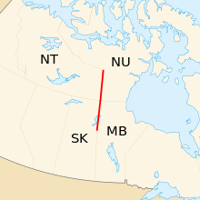
In Canada, part of the border between the Northwest Territories and Nunavut is defined by the meridian, and part of the border between Saskatchewan and Manitoba runs about 400m west of the meridian. At the 60th parallel north, these borders form a (possible) quadripoint at the four corners of these provinces and territories. 102°W is the Second Meridian of Canada's Dominion Land Survey.
In the United States, the meridian formed the eastern border of the historic and extralegal Territory of Jefferson. The eastern border of Colorado with Nebraska and Kansas lies on the 25th meridian west from Washington, which lies a couple of miles west of the 102nd meridian west.
From Pole to Pole
Starting at the North Pole and heading south to the South Pole, the 102nd meridian west passes through:
Co-ordinates Country, territory or sea Notes 90°0′N 102°0′W Arctic Ocean 79°30′N 102°0′W Peary Channel 79°5′N 102°0′W Canada Nunavut — Ellef Ringnes Island 78°17′N 102°0′W Danish Strait 77°53′N 102°0′W Canada Nunavut — King Christian Island 77°41′N 102°0′W Unnamed waterbody Passing just west of Helena Island, Nunavut, Canada (at 76°35′N 101°41′W) 76°25′N 102°0′W Canada Nunavut — Bathurst Island 76°13′N 102°0′W Erskine Inlet 75°58′N 102°0′W Canada Nunavut — Alexander Island and Bathurst Island 75°33′N 102°0′W Parry Channel Viscount Melville Sound 73°4′N 102°0′W Canada Nunavut — Prince of Wales Island 72°30′N 102°0′W M'Clintock Channel 70°18′N 102°0′W Canada Nunavut — Victoria Island 69°51′N 102°0′W Albert Edward Bay 69°28′N 102°0′W Canada Nunavut — Victoria Island 68°59′N 102°0′W Queen Maud Gulf 68°50′N 102°0′W Canada Nunavut — Qikiqtaryuaq 68°37′N 102°0′W Queen Maud Gulf 67°45′N 102°0′W Canada Nunavut
Northwest Territories / Nunavut border — from 64°14′N 102°0′W
Manitoba — from 60°0′N 102°0′W, running about 400m east of, and parallel to, the border with Saskatchewan
Saskatchewan — from 55°47′N 102°0′W49°0′N 102°0′W United States North Dakota
South Dakota — from 45°56′N 102°0′W
Nebraska — from 43°0′N 102°0′W
Kansas — from 40°0′N 102°0′W
Oklahoma — from 37°0′N 102°0′W
Texas — from 36°30′N 102°0′W29°48′N 102°0′W Mexico Coahuila
Zacatecas — from 25°5′N 102°0′W
San Luis Potosí — from 23°24′N 102°0′W
Zacatecas — from 22°40′N 102°0′W
Aguascalientes — from 22°16′N 102°0′W
Jalisco — from 21°53′N 102°0′W
Guanajuato — from 20°56′N 102°0′W
Jalisco — from 20°39′N 102°0′W
Guanajuato — from 20°31′N 102°0′W
Michoacán — from 20°21′N 102°0′W, passing just east of Uruapan
Guerrero — from 18°12′N 102°0′W17°58′N 102°0′W Pacific Ocean 60°0′S 102°0′W Southern Ocean 71°58′S 102°0′W Antarctica Unclaimed territory